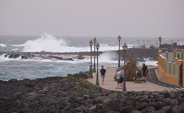
Storm Olivier has sparked yellow and orange weather warnings for parts of the . Heavy rain, and strong winds are forecast to strike across the archipelago from today (April 8) and possibly into tomorrow.
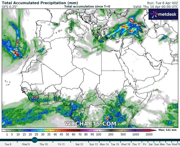
Northern will be under a yellow alert from midnight until 9am local time on Wednesday, with rainfall tipped to reach 20mm per hour. An orange alert is due to take effect from 6pm to 11.59pm for the north of the island as well as eastern, southern and western slopes. Here rainfall is forecast to measure 30mm per hour, according to the .
Much of the rest of the island will be under a yellow alert for thunderstorms over the same period on top of another yellow alert for strong winds, gusting up to 44mph (70km/h) in the east, south and west.
Unsettled weather is also forecast in , with a yellow alert from midnight tonight until 9am local time on Wednesday covering the north, highlandsz, eastern, southern and western slopes. Up to 15mm is expected per hour here.
Yellow weather alerts for heavy rain and thunderstorms also apply to Fuerteventura and from 6am to 3pm on Wednesday, with rainfall levels possibly reaching 15mm per hour.
Meanwhile, La Palma is due to be under an orange alert for intense rainfall from 3pm until 11.59pm tomorrow. Rainfall could reach 30mm per hour in the island's north, east and western parts.
A yellow alert is also due to come into force over the same period for up to 80mm of rain over 12 hours. To add to the weather misery, La Palma will a yellow storm warning takes effect from 6pm to midnight, with a yellow wind warning from 3pm to 9pm on higher ground.
An orange alert for rain applies to from 6pm to 11.59pm tomorrow. It covers the whole island, with rainfall up to 30mm per hour here too. There are also yellow warnings for wind and thunderstorms over the same period.
Finally, El Hierro will be under an orange alert for rain between 6pm and 11.59pm. A yellow warning for storms will come into effect from 3pm until 9pm the same day, with another yellow alert for strong winds in force from 6pm to 11.59pm.
Meanwhile, days of unrelenting downpours in the US have swollen rivers to near record levels across Kentucky, flooding neighbourhoods and threatening a famed bourbon distillery in the state capital.
Persistent storms have killed at least 23 people since last week as they hit the region with heavy rain and spawned destructive tornadoes.
At least 157 tornadoes struck within seven days beginning on March 30, according to a preliminary report from the US National Weather Service.
Though the storms have moved on, the flood danger remains high in several other states, including parts of Tennessee, Arkansas and Indiana.
Floodwaters forced the closure of the historic Buffalo Trace Distillery, close to the banks of the swollen Kentucky River near downtown Frankfort.