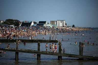
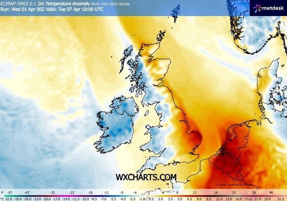
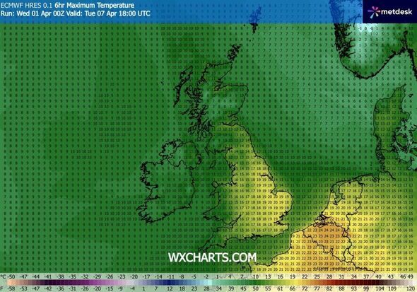
The latest weather maps are suggesting some parts of the UK could enjoy warm temperatures of up to 20C as the country could be affected by a "temperature anomaly".
Maps issued by WXCharts.com said this phenomenon could affect the UK next week, on April 7. The north east of Scotland, the north east of England, and the south east will likely enjoy warm spells with temperatures that could also be as high as 20C, while other areas of the country could see temperatures fall below 0C.
This forecast followed a yellow weather warning for wind issued for the Easter weekend. The warning covered all of Scotland and Northern Ireland, as well as a swathe of north west England and some of north Wales. It comes into force at 6pm on Saturday and runs until noon on Easter Sunday.
The Met Office's long-range forecast covering the period from April 6 to April 15 read: "Rather changeable conditions are expected through this period, as a series of Atlantic frontal systems track eastwards across the UK, accompanied by some strong winds at times.
"These will bring occasional spells of rain or showers, heaviest and most frequent in the west and northwest, with longer drier interludes likely in the south and sheltered eastern areas. Whilst temperatures will be close to average for the period as a whole, there may be opportunities for some short-lived warm spells in the south and east. Conversely, occasional colder interludes in the northwest will bring the chance of some wintry showers, especially to hills, and overnight frost."
The forecast adds: "A spell of very strong winds later Saturday and overnight into Easter Sunday morning may cause some damage and travel disruption."
Forecasters said gusts of 50-60mph are expected "fairly widely", possibly rising to 60-70mph in exposed locations and as high as 80-90mph in western areas of Scotland. The public has been warned to expect delays to road, rail, air and ferry transport, with potential cancellations for some services.
Delays for high-sided vehicles on exposed routes and bridges are likely, with a chance that some roads and bridges could close.
Met Office deputy chief meteorologist Dan Holley said: "A significant cold plunge from Canada into the North Atlantic will impact our weekend weather, strengthening the jet stream and spinning up a deep area of low pressure towards the north-west of the UK on Saturday night. This will lead to a spell of very strong winds later on Saturday and overnight into the morning of Easter Sunday.
Separate figures published by the Met Office on Wednesday show March was provisionally one of the warmest on record in England and Wales. Long periods of above-average temperatures and prolonged sunshine helped Wales experience its joint fourth-warmest March and England its joint sixth-warmest since comparable data began in 1884. Across the whole of the UK it was the joint 10th warmest March on record.
Scotland
Aberdeenshire
Moray
Angus
Fife
Perth
England
Northumberland
Durham
North Yorkshire
West Yorkshire
East Yorkshire
South Yorkshire
Lincolnshire
Leicestershire
Cambridgeshire
Northamptonshire
Derbyshire
Bedfordshire
Hertfordshire
Hampshire
Berkshire
Essex
Suffolk
Kent
Surrey
West Sussex
East Sussex
Oxfordshire
Buckinghamshire
Dorset
Isle of Wight
Contact to : xlf550402@gmail.com
Copyright © boyuanhulian 2020 - 2023. All Right Reserved.