Forecasters at BBC Weather are warning of an "enhanced risk" of colder spells in April due to "air masses of Arctic origin" - and they are refusing to rule out the possibility of more . Netweather forecasters also believe more snow could be on the way.
's long-range outlook for March 31 to April 13 states that different models all show "a stronger and longer lasting high pressure signal over the far north-west and far north of ". This is expected to bring an "enhanced risk" of colder spells, with air masses from the Arctic "potentially" moving southward to cover the UK.
READ MORE:
The forecast adds that the "increasing risk of another cold snap" means there will also be an "ongoing risk of late overnight frosts". It concludes: "Even wintry precipitation cannot be ruled out completely, but it will probably be confined to the higher ground or parts of northern ."
Netweather's long-range outlook for March 31 to April 6 says temperatures are expected to be "generally near to slightly below normal" at the start of next month. There is also a chance snow could fall at lower levels. The forecast states: "Snow [will be] restricted to high ground, mainly in the north, and just a slight chance of wintry showers penetrating to low levels on occasion."
The forecast differs from BBC's and Netweather's predictions. The national weather agency expects "large day-to-day swings" in temperatures next month.
Its forecast for April 3 to April 17 states: "Confidence is lower than normal, but blocked or slow-moving weather patterns are most probable for the first half of April. This can lead to slow-moving areas of low and high pressure and, depending on their location, this can result in extended periods of either dry conditions (slightly more-likely) or wetter episodes in the form of rain or showers (slightly less-likely). Temperatures will vary, with some large day-to-day swings possible, but overall are likely to be near average."
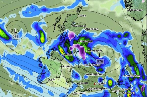
The latest weather modelling maps from WX Charts show snow falling in northern England and Scotland in the early hours of April 1. Snow could be falling at a rate of around 2cm per hour where flurries are most intense, according to data from the GFS weather model.
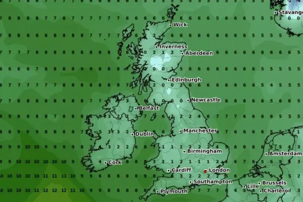
Temperature maps also show the mercury could drop as low as 0C in some parts of the country at the start of next month. At 6am on April 2, the data shows some parts of Scotland and northern England will struggle to top 0C. Temperatures are expected to be highest in East Anglia, but might only peak at 4C.
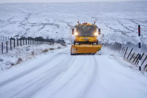
This comes after in the UK, with daytime peaks of 0C possibly right around the corner.